
Spitakavor Church (Ashtarak)
Spitakavor Church is located in Aragatsotn Region.The church has overcome a number of attacks and…
Read More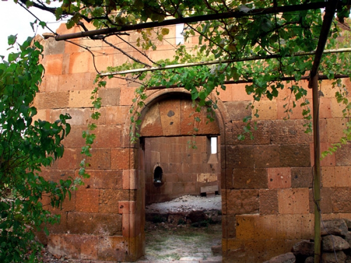
Spitakavor Church is located in Aragatsotn Region.The church has overcome a number of attacks and…
Read More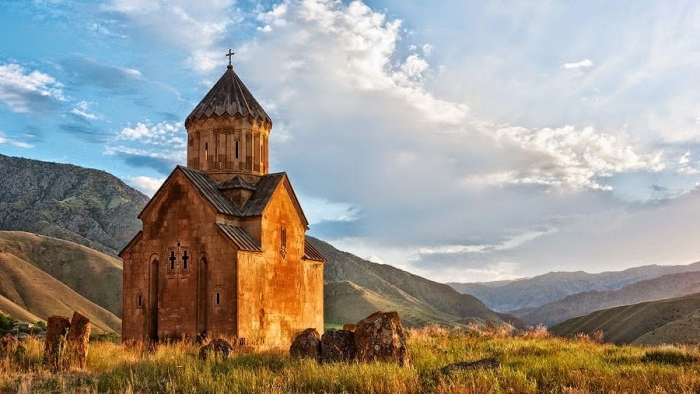
Astvatsatsin is located on the top of a high hill that overlooks Arpa River in…
Read More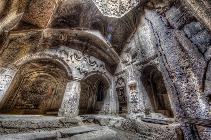
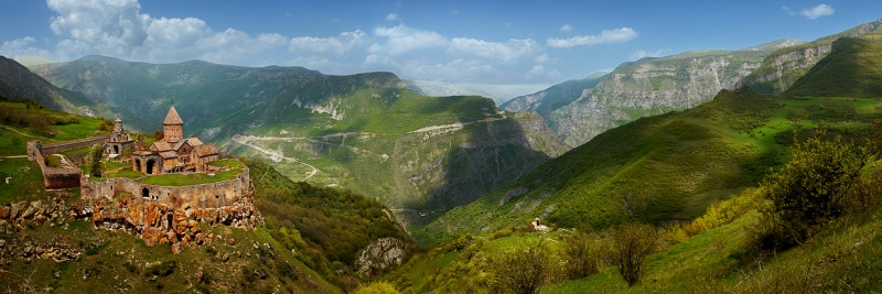
Geghard is one of the most visited sites in Armenia,located in nearby Garni Temple in…
Read More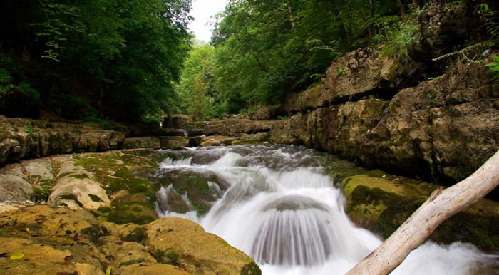
Area- 2308 km 2
Population - 69400
Administrative Center - Yeghegnadzor City
Distance from Yerevan to Yeghegnadzor - 119 km
Lakes - Sevakn, Jukhtak, Hreshtak, Kechut water reserve.
Rivers - Arpa, Yeghegis, Herher
Highest Mountains - Vardenis range, Vayk Range
Big Cities - Yeghegnadzor (center), Vayk, Jermuk
Popular places and sights - Areni-1 cave complex and the Winery of the Chalcolithic age, Areni village, Areni Church, Noravank monastery, Orbelian's Caravanserai, Jermuk Resort Town, Gndevank, Kechut Reserve.
The Region of VayotsDzor is home to numerous historical and ancient landmarks including the Areni-1 cave complex where archeologists have found a leather shoes which has more than 5,500 years old and a winery of Chalcolithic Age.
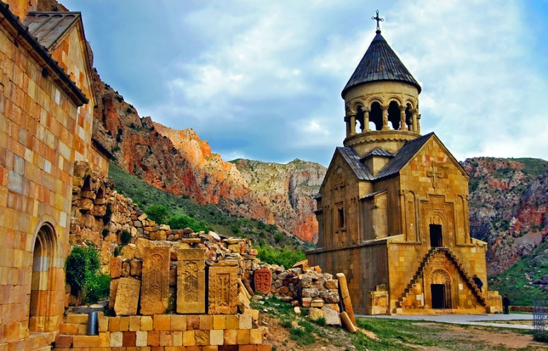
Another architectural wonder of Armenia is the 13th century Noravank Monastery which has unique approach to church architecture of the time. It is made of limestone which makes it original amongst other monasteries of the time and not only.
Area -2695 km 2
Population - 156500
Administrative Center - Ijevan City
Lakes - Lake Parz, Lake Gosh
Rivers - Aghstev, Getik, Voskepar, Sarnajur, Akhum, Tavush and Khndzorut
Big Cities - Dilijan, Noyemberyan, Berd, Ayrum
Popular places and sights - Makaravank monastery, JukhtakVank monastery, Goshavank monastery, Haghartsin Monastery, Lake Gosh and Parz, Dilijan National Park, IjevanDendropark.
The Region of Tavush is located on the north-east of the country and has the highest percentage of forests in Armenia. Tavush has been a spa destination from early 20th century up now with a number of spa towns and resorts in the region. The second largest city is Dilijan, which is going to become the banking center of Armenia.
Area - 4475 km 2
Population - 164000
Administrative Center - Kapan City
Distance from Yerevan to Kapan - 316 km
Lakes - Sev lich, Gogi, Tsaghkar,Gazan, Spandaryan water reserve, Tolors, Shaki water reserve.
Rivers - Araks, Vorotan, Sisian
Highest Mountains - Bargushat range, Arevik range, Zangezour range
Big Cities - Kapan (center), Goris, Sisian, Kajaran, Meghri
Popular places and sights - Shaki beautiful waterfall, Spandaryan lake (popular with its fishing area), Karahunj (Zorats Karer) ancient observatory, Tatev monastery, Tatev world's longest cable car, Khndzoresk rope-bridge, Old inhabitations in Khndzoresk and Tegh villages, Shikahogh reservation.
The mountainous Region of Syunik is located in the extreme south of Armenia. It was one of the 15 provinces of the ancient Armenian Kingdom. The region is home to one of the wonders of the Armenian medieval architecture, Tatev Monastery Complex (9th century). The biggest medieval university was founded in the monastery by the Armenian scholar Grigor Tatevatsi in the 14th century.
Area - 2038 km 2
Population - 361400
Administrative Center - Gyumri
Distance from Yerevan to Gyumri -155 km
Lakes – Lake Arpi, Arpa,
Rivers –Akhurian, Yeghnajur, Karmrajur, Elal
Popular places and sights - Sev Berd fortress, Yererouk Basilica, Harichavank Monastery, Marmashen Monastery, Church of the Holy Saviour (Gyumri), Cathedral of the Holy Mother of God (Gyumri), YotVerk.
The Region of Shirak is located in the north-west of the country with Gyumri administrative center as the second largest city of Armenia. The Akhuryan valley is home to many ancient human settlements dating back to 9000 BC. The region has been settled from the early Stone Age. The fertile Shirak plain is the largest producer of grains and potato in Armenia. The irrigation system in the province is highly developed.
Area -3750 km 2
Population - 392300
Administrative Center - Vanadzor City
Distance from Yerevan to Vanadzor - 125 km
Highest Mountains - Mount Achkasar, Bazum, Pambak, Gugark
Rivers – Debed, Dzoraget, Pambak and Martsaget
Big Cities - Stepanavan, Alaverdi and Spitak
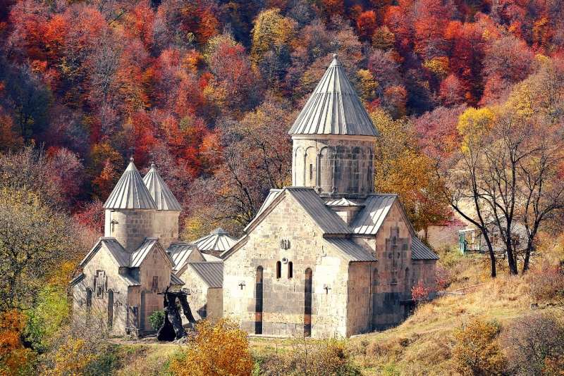
Popular and interesting sights- Akhtala Fortress,Sanahin Bridge, Odzun Church, Sanahin and Haghpat Monasteries,Akhtala Monastery,StepanavanDendropark, Vanadzor Botanical Garden, HovhannesTumanyan in Dsegh.
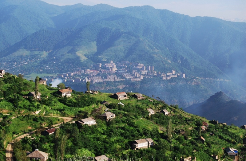
Lori is the most populated region of Armenia. It is home to some of the historic landmarks of Armenia that are listed in UNESCO World Heritage Sites; among them are Sanahin and Haghpat Monastery Complexes.
Lori is a major centre for metallurgical business. However, the Alaverdi copper smelter owned and operated by the "Armenian Copper Programme" company is the only smelter of the province. Copper mines are located in Alaverdi, Akhtala, Shamlugh and Teghut.
Area - 2038 km 2
Population - 328900
Administrative Center - Hrazdan City
Distance from Yerevan to Hrazdan - 50 km
Lakes - Akna Lich
Rivers - Hrazdan, Getar, Marmarik
Highest Mountains - Pambak and Geghama range
Big Cities - Hrazdan (center), Abovyan, Charentsavan, Nor Hachn, Yeghvard, Byureghavan, Tsaghkadzor, Arzni
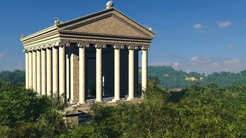
Popular places and sights - Arzni, Bjni, Hankavan and Tsaghkadzor resort cities, Garni Pagan Temple, Geghard Monastery complex, Erenbuni State Reserve.
The Kotayk Region is situated in the central part of Armenia and has no border with any country. The region is home to many historical monuments with Geghard Monastery Complex (13th century) included in the list of UNESCO Heritage sites. The only standing Pagan Temple in the Caucasus is the Garni Temple (1st century AD) situated in the same name village. During USSR times Kotayk was one of the most industrialized regions of Armenia.
Area - 4058 km 2
Population - 278600
Administrative Center - Gavar City
Distance from Yerevan to Gavar - 98 km
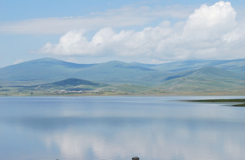
Lakes - Sevan Lake, Aghi Lich
Rivers - Hrazdan, Vardenis, Getik
Highest Mountains - Geghama Range, Arjanots, Sevan Range, Vardenis Range
Big Cities - Gavar (center), Sevan city, Martuni, Vardenis, Chambarak
Popular places and sights - Noratus cross-stones (khachkars) cemetery , Martuni, St.Astvatsatsin, St Gevorg, Vanevan churches, Sevan Lake, Berdkunk, Hayravank, Sevan peninsula, Sevan National Park.
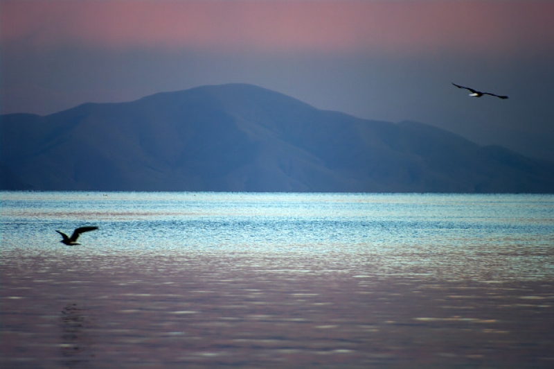
Located in the eastern part of Armenia, Gegharkunik is the largest region in Armenia. Lake Sevan is situated in the region which is the largest lake in Caucasus and one of the highest mountainous sweet water lakes in the world. The lake has a medieval monastic complex on the Sevan peninsula which has one of the four unique allsaviour cross-stones in the Saint Holy Mother (Surb Astvatsatsin, 9th century). The Sevan-Dilijan important highway runs through the region.
Area - 1251 km 2
Population - 323300
Administrative Center - Armavir City
Distance from Yerevan to Armavir - 48 km
Lakes - Aighr Lich
Rivers - Araks (Arax), Kasakh, Sevjur, Armavir
Big Cities – Etchmiadzin (Vagharshapat)
Popular places and sights - Zvartnots Temple, St Gayane, St Hripsime, St Shoghakat Monasteries and Etchmiadzin Cathedral, Sardarapat Memorial Complex, Metsamor archaeological site, Argishtikhinili ancient city.
The Armavir region is situated on the west part o f Armenia, in the Ararat valley, between Ararat and Aragats Mounts. With its populous city Etchmiadzin, Armavir is known to be the spiritual center of all the Armenians, where one of the ancient cathedrals, Etchmiadzin Catedral has been built in the 4th century.
Area - 1995 km 2
Population - 311400
Administrative Center - Artashat City
Distance from Yerevan to Artashat - 29 km
Lakes - Sev Lich, Azat water reserv., Armush, Vanki Lich, Karalich
Rivers - Araks (Arax), Azat, Hrazdan, Yotnakunk
Highest Mountains - Yeranos, Kotuts, Vishapasar
Big Cities - Artsahsat (adm. center), Ararat town, Vedi, Masis
Popular and interesting sights - archaeological sites of ancient Dvin, Artashat and Kakavaberd fortress, Khosrov national park (Khosrov forest), KhorVirap Monastery.
The history of today’s Artashat city goes back as early as the 176 BC, when the Armenian King ArtashesI founded the city in the Vostan Hayots canton. According to the the century Armenian History Movses Khorenatsi, Artashes liked the position of the hills which was the location of the confluence of the Yeraskh and Metsamor rivers. The Greek historians Plutarch and Strabo give in their accounts the version that the city Artashat was built and developed on the advice of the Carthaginian general Hannibal.
